

.jpg)


.svg)
As rain and wind continue to lash parts of the UK, Somerset has declared a major emergency following overnight floods. As the UK recovers from Storm Eowyn, more than 50 flood warnings are in effect throughout England, and two are in effect in Scotland. Residents in the worst-affected sections of Somerset have been evacuated from their homes.
To address the possible effects of the weaker Storm Herminia, a low pressure system named by Spanish meteorologists, which is predicted to experience the greatest winds, a number of weather warnings have been issued, including a new yellow rain advisory that was issued on Monday morning.
A yellow alert for rain was issued by the Met Office at 7.58am on Monday covering parts of southern England until 10am on Tuesday, warning of heavy rain, possible thunderstorms and flooding.
⚠️ Yellow weather warning updated ⚠️
— Met Office (@metoffice) January 27, 2025
Heavy rain across parts of Wales
Valid until 2100 Tuesday
Latest info 👉 https://t.co/QwDLMfRBfs
Stay #WeatherAware⚠️ pic.twitter.com/wwgZTdO0lY
Another yellow warning for rain is in place until 11.59pm covering large swathes of Wales and parts of the West Midlands, with the Met Office predicting 0.8in to 1.6in (20mm to 40mm to fall quite widely and 2in to 2.8in (50mm to 70mm) on higher ground.
And a yellow wind alert is in force until 6am on Tuesday for southern England and parts of Wales, with gusts of 50mph to 70mph possible at times.
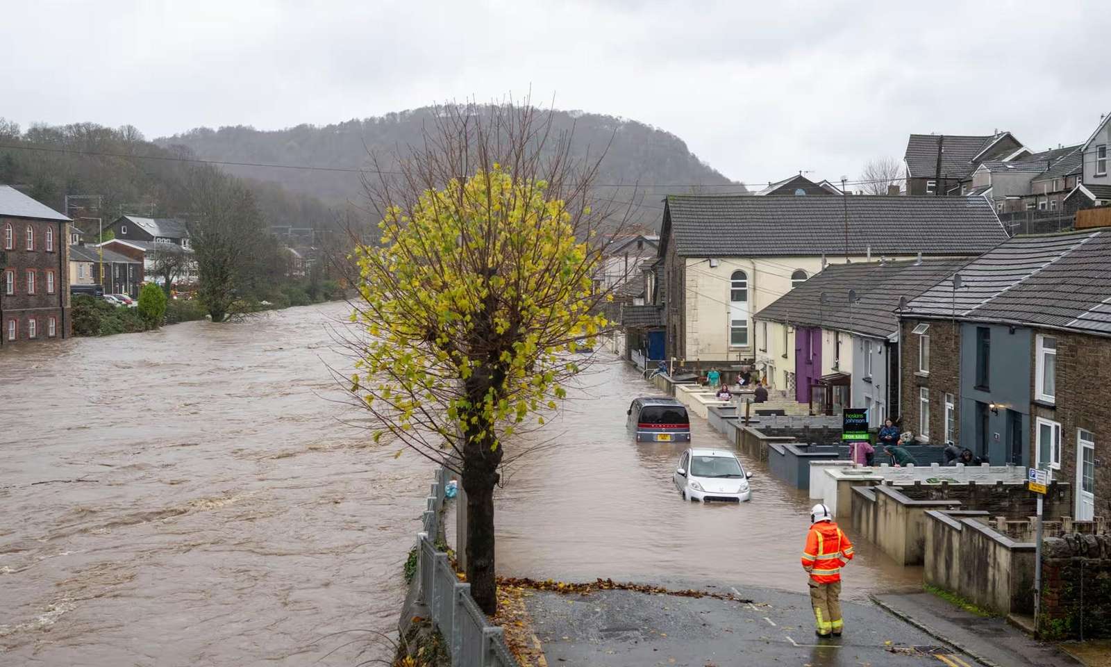
With further heavy rainfall expected to fall in the early hours of Monday morning, a major incident was called and a decision was made to carry out precautionary evacuations for residents living in properties in the worst affected areas, as well as a caravan site thought to be at risk
Somerset Council spokesman
Somerset Council and police jointly declared a major incident in the region.
A council spokesman said: “Following intense rainfall across the region at the weekend, several parts of Somerset were flooded on Sunday afternoon, including roads and some homes in the centre of Chard and Ilminster.
“With further heavy rainfall expected to fall in the early hours of Monday morning, a major incident was called and a decision was made to carry out precautionary evacuations for residents living in properties in the worst affected areas, as well as a caravan site thought to be at risk.
“Rest centres were set up in Chard, Ilminster and Somerton, and all the relevant agencies will continue to work to keep residents safe.”
Met Office meteorologist Marco Petagna warned of unsettled conditions across the country.
“We’ve got a pretty unsettled picture across the UK, with bands of showers moving in from the south west, moving north and east across pretty much all parts as we go through the day,” he said.
“(There) could be a bit of a wintry mix at times across the hills of Scotland and wherever you are those showers will be accompanied by pretty blustery conditions, with gales particularly down towards the South and South West of the UK, with parts of Wales perhaps seeing some of the heaviest bursts of rain.”
Mr Petagna said temperatures are close to the seasonal average, ranging from 6C to 10C, adding: “But if we add on the effect of those showers and those brisk winds, it’s certainly going to feel much colder out and about.”