


_3.jpg)


.svg)
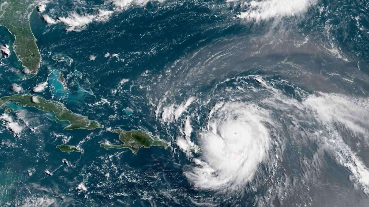
A powerful storm moving through the Caribbean Sea has weakened after initially reaching extreme wind speeds of up to 160mph.
Hurricane Erin — the first hurricane of the 2025 Atlantic season — intensified from sustained winds of 100mph (160kph) to a peak of 160mph (255kph), briefly hitting Category 5 status. It later dropped to Category 4 and was further downgraded early Sunday to a Category 3, according to the US National Hurricane Center (NHC).
The storm strengthened on Saturday as it tracked westward past the Leeward Islands — which include Anguilla, Guadeloupe, and the Virgin Islands. By the evening, the NHC reported Erin was undergoing “structural changes” but remained “formidable,” with heavy rain and strong winds sweeping across Puerto Rico.
Although not expected to make landfall, Erin is forecast to generate dangerous surf and rip currents as it curves northward next week. Beaches in the Bahamas, the US East Coast, and Atlantic Canada are likely to feel its effects. Exposed US coastal regions such as Long Island, New York, and Cape Cod face the risk of severe tropical storm or hurricane conditions, meteorologists at AccuWeather warned.
Tropical storm watches have been issued for several Caribbean islands, including St Barts and St Maarten, as Erin’s outer bands bring rain and strong winds. The NHC has also cautioned that heavy rainfall could trigger flash flooding, landslides, and mudslides across Puerto Rico and the Virgin Islands on Sunday.
In preparation, the US government dispatched over 200 emergency personnel, including FEMA staff, to Puerto Rico earlier in the week when a flood watch was declared.
Despite being relatively compact, with hurricane-force winds extending about 30 miles from its center, Erin is expected to stay at major hurricane strength until late next week before gradually weakening.
Meteorologists note that storms like Erin, which intensify rapidly, pose challenges for forecasting and emergency response planning. Scientists link such rapid intensification to climate change, as warmer oceans and a moister atmosphere provide hurricanes with extra energy to strengthen faster and release heavier rainfall.
Erin marks the fifth named storm of the 2025 Atlantic season, which runs from June 1 to November 30, and the first to develop into a full hurricane.